
New satellite images are a jarring reminder of the massive transformations humans have made to the planet.
Google partnered with TIME, NASA and the U.S. Geological Survey (USGS) to create a tool that compiles 28 years of satellite images. The Timelapse Project, which lets you search any spot in the globe and scroll through nearly three decades of Earth’s history.
Using Google Earth Engine technology to comb through about 900 terabytes of imagery, Google picked and polished the best satellite images—one for every year—at every single location in the world.
Then the company chose handful of some of the most jarring changes and created GIFs.
They may lack the laughs of your typical GIF’s showing pet antics. But the prolific visual information is a great tool to educate the public about just how much impact human activity is having.
“We also hope it can inform the global community’s thinking about how we live on our planet and the policies that will guide us in the future,” Google said on its official blog.
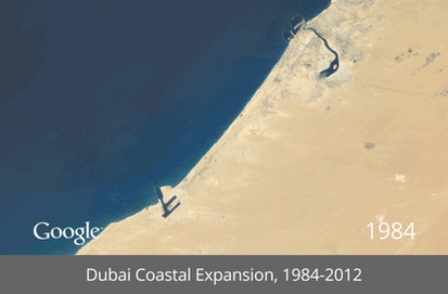
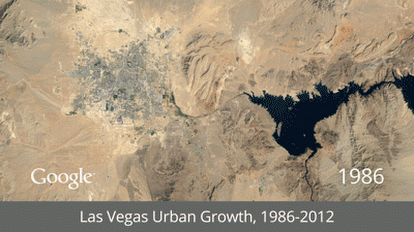
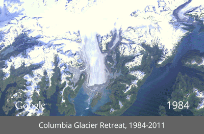
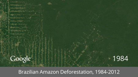
Urbanization in Las Vegas, deforestation in the Amazon and the retreat of the Columbia Glacier in Alaska are just some of the most visually jarring examples provided by Google.
Timelapse’s ability to visualize human interaction with Earth on such a massive scale is a great educational tool for environmentalists. But it’s also great way to spend 30 minutes satisfying your curiosity. Make sure to click on “Explore The World” within the Timelapse interface, there you can direct your own timeline—the changes right here in Seattle are quite interesting.
For more information about the process, visit Timelapse and for all 7 of the Google GIFs visit the +Google site.
1 Comment
Comments are closed.